This package provide a user-friendly interface to AWX data, it can read 3 type AWX, that is
- Product Type 1, geostationary satellite image product
- Product Type 2, polar orbiting satellite image product
- Product Type 3, Grid product
install from pypi
pip install awx1 Read data, access data values, slicing longitude and latitude and save to netCDF
import os
from awx import Awx

pathfile = r'../sampledata/ANI_VIS_R02_20230217_1000_FY2G.AWX'
ds = Awx(pathfile)

# print file head information
print(ds)

# get satellite observation data in xarray.DataArray format
print(ds.values)

# clip data to given longitude and latitude extent
print(ds.sel(lat=slice(20, 40), lon=slice(100, 130)))

# save data to netcdf4
ds.values.to_netcdf('ANI_VIS_R02_20230217_1000_FY2G.nc')
2 Basic draw data without projection
# draw data use matplotlib

import matplotlib.pyplot as plt
from awx import Awx

fpath = r'./sampledata/ANI_VIS_R02_20230217_1000_FY2G.AWX'
ds = Awx(pathfile=fpath)
print(ds)
dar = ds.values.squeeze()
plt.pcolormesh(dar.lon, dar.lat, dar, cmap='Greys_r')
plt.savefig('ANI_VIS_R02_20230217_1000_FY2G_NoProj.png', dpi=300)
plt.show()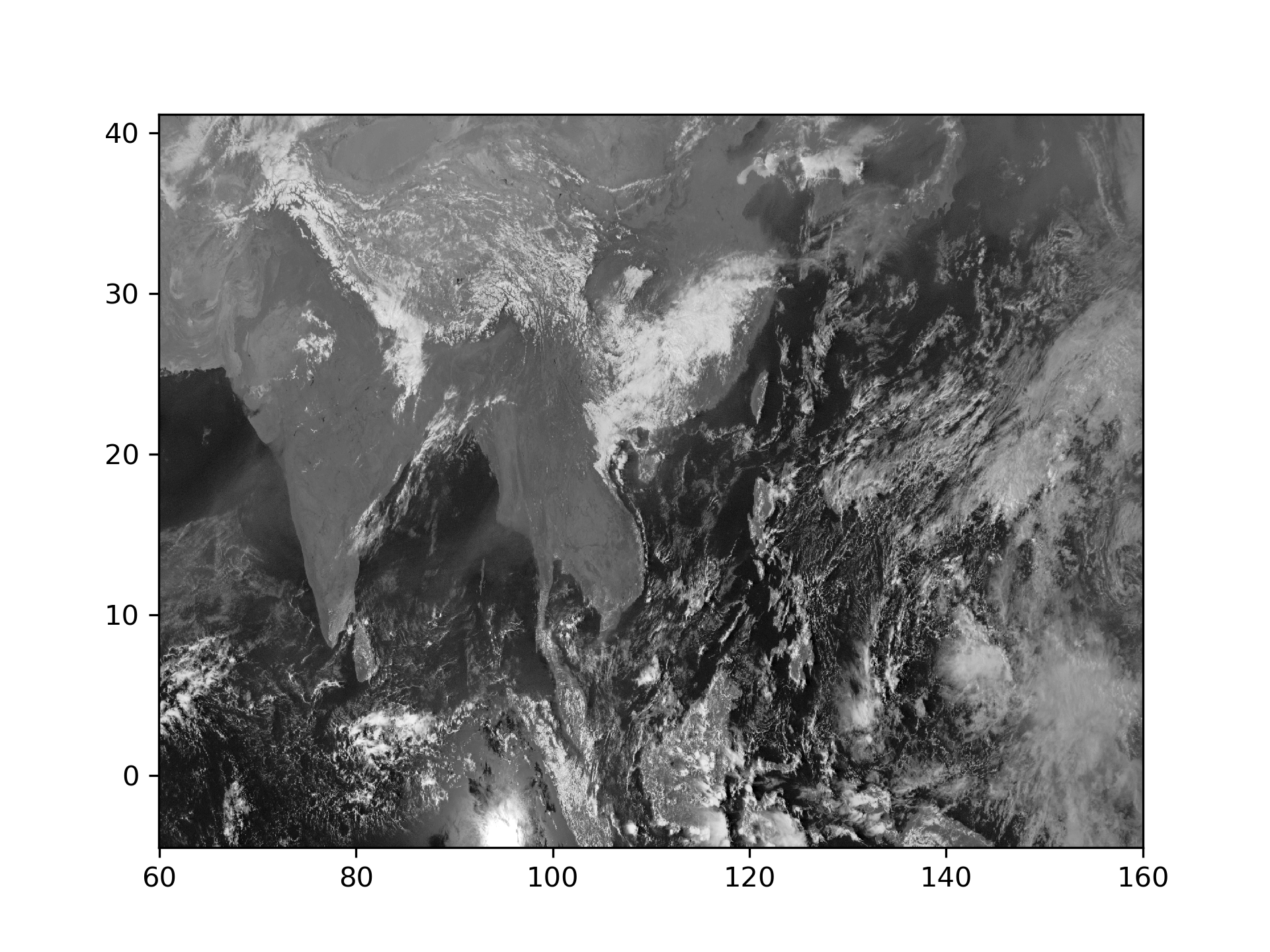
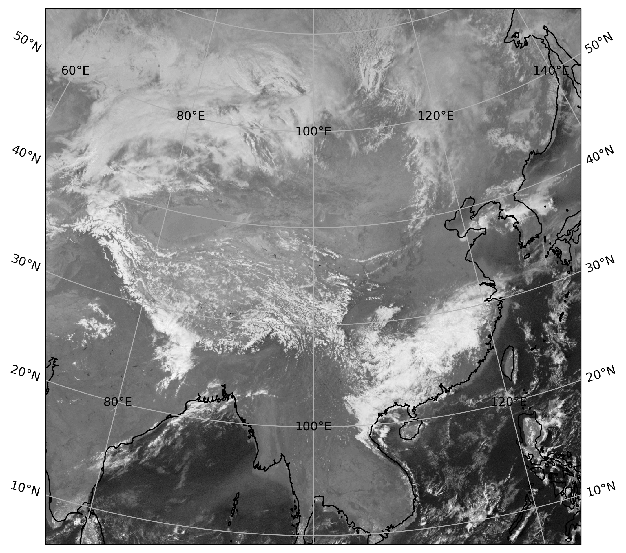
3 Draw data in native projection
# draw data in projection coordination
import os
import cartopy.crs as ccrs
import matplotlib.pyplot as plt
from awx import Awx

# fpath = r'./sampledata/ANI_VIS_R02_20230308_1400_FY2G.AWX'  # Mercator
fpath = r'./sampledata/ANI_VIS_R01_20230308_1400_FY2G.AWX'  # lambert
ds = Awx(pathfile=fpath)
print(ds)
dar = ds.values.squeeze()

plt.figure(figsize=(8, 8))

if dar.projection == 1:
    proj = ccrs.LambertConformal(central_longitude=dar.clon / 100,
                                 central_latitude=dar.clat / 100,
                                 standard_parallels=(dar.std_lat1_or_lon / 100.,
                                                     dar.std_lat2 / 100.))
    extent = [dar.x.min(), dar.x.max(), dar.y.min(), dar.y.max()]
elif dar.projection == 2:
    proj = ccrs.Mercator(central_longitude=dar.clon / 100,
                         latitude_true_scale=dar.std_lat1_or_lon / 100.)
    extent = [dar.x.min(), dar.x.max(), dar.y.min(), dar.y.max()]
elif dar.projection == 4:
    proj = ccrs.PlateCarree(central_longitude=dar.clon / 100.)
    extent = [dar.lon.min(), dar.lon.max(), dar.lat.min(), dar.lat.max()]
else:
    raise NotImplementedError()
ax = plt.axes(projection=proj)
ax.set_extent(extent, crs=proj)
ax.coastlines(resolution='110m')
ax.gridlines(draw_labels=True)
ax.pcolormesh(dar.x, dar.y, dar, cmap='Greys_r')
plt.savefig(os.path.splitext(os.path.basename(fpath))[0] + '.png', dpi=300, bbox_inches='tight')
plt.show()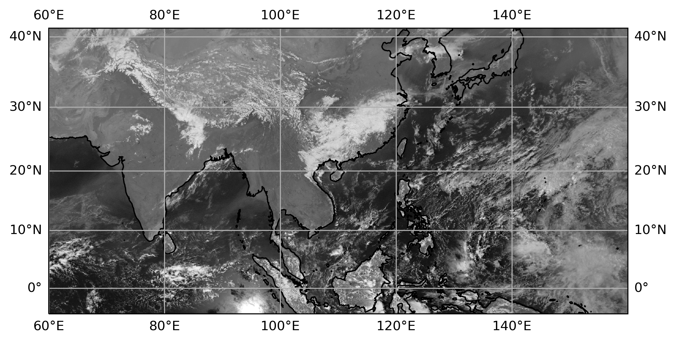
Print AWX file head information
Usage:
awx_info AWX_File_Name
Example:
awx_info FY2G_TBB_IR1_OTG_20150729_0000.AWX
Convert AWX file to netCDF4 file
Usage:
awx_to_nc AWX_File_Name NetCDF_File_Name
Example:
awx_to_nc FY2G_TBB_IR1_OTG_20150729_0000.AWX FY2G_TBB_IR1_OTG_20150729_0000.nc